From the village of La Forclaz, a small road will lead you to Ferpècle along the peaks of Les Haudères, after Evolène. After passing some hamlets which are typical of Val d’Hérens, as well as a striking view of the Dent Blanche, you will pass the iconic Col d’Hérens hotel dating from the 19th century and standing at an altitude of 1,766m. Your hike will start from the nearby car park. This trail is accessible from spring to autumn, with snow making this hike inaccessible in the winter.
Hike to reach out and touch the Mont Miné glacier
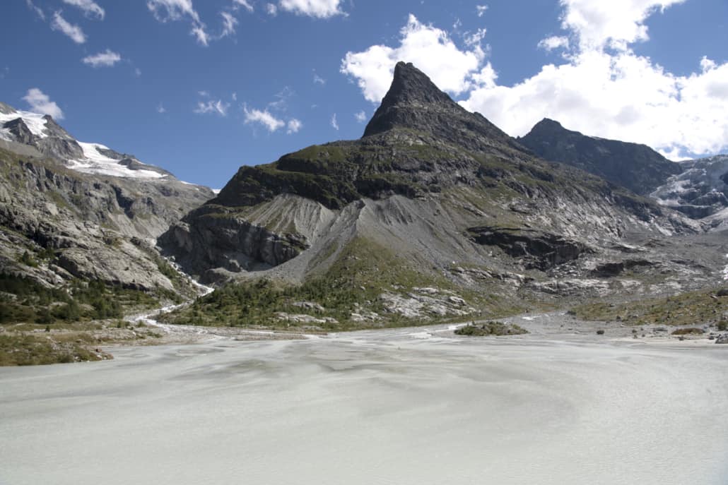
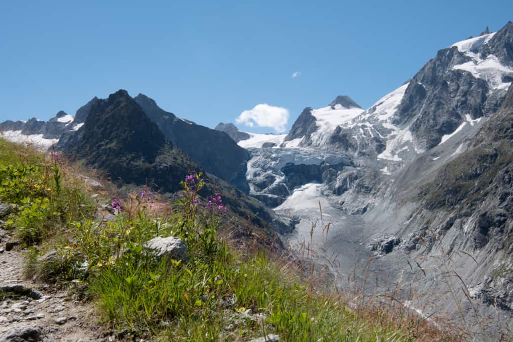
Head to the bottom of the Mont Miné glacier, altitude 2,000m, by following the small mountain road on a slight incline up to the Ferpècle dam (1,882m).
Continue along a pretty, relatively flat footpath following a stream flowing directly from the glacier, with the Dent Blanche to admire ahead of you. In less than 45 minutes, you will find yourself in the high mountains on a glacial plain, classified as an alluvial site of national importance with a tundra-like landscape. Opposite, you’ll see Mont-Miné, with the glacier of the same name on the right at an altitude of 1,960m, and on the left its twin, the Ferpècle glacier.
Fauna and flora
A wild hike, yet easily accessible and ideal for the family, you will never tire of the different landscapes guiding you throughout your walk: mountain streams, rocks, perennial plants and rhododendrons, and even deciduous and larch tree forests.
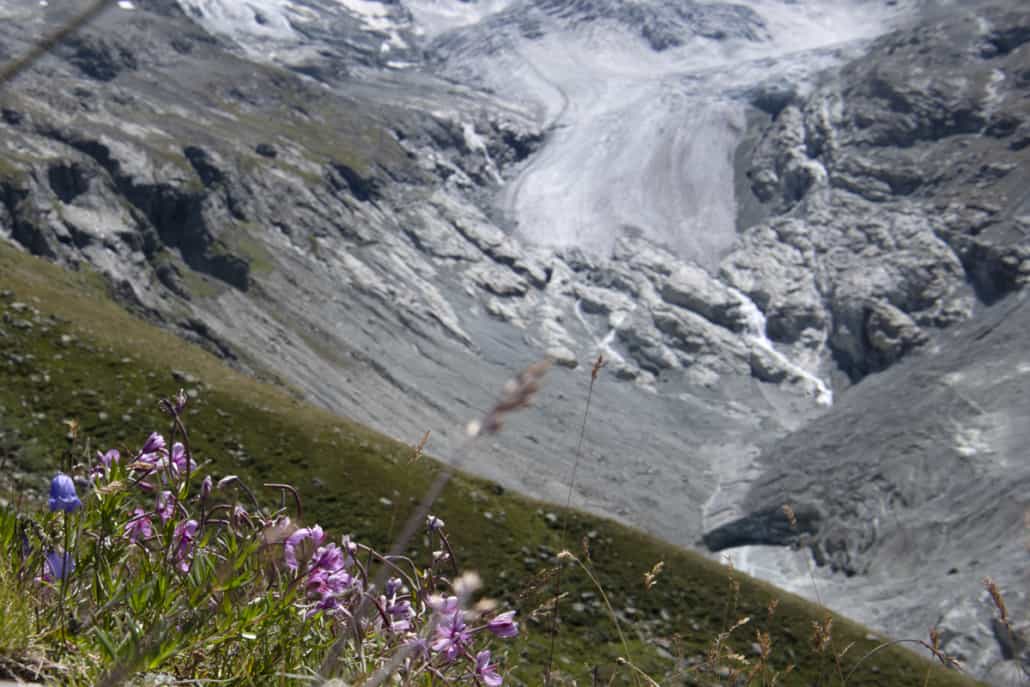
Photography enthusiasts can look out for “gouilles”: small lakes that have formed over time which reflect the surrounding peaks.
And don’t miss encounters with sheep and cows grazing near the stream. With a bit of luck, you might even spot a few ibex and marmots.
For picnics, there are many rocky outcrops where you can find a place to sit.
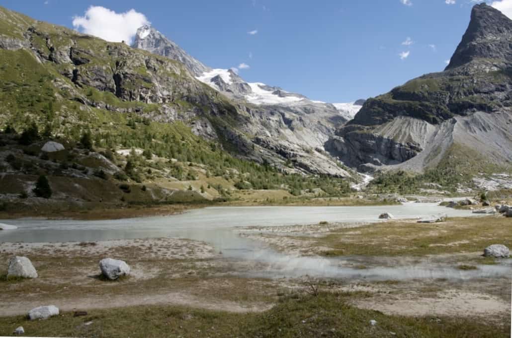
The bucolic Ferpècle valley
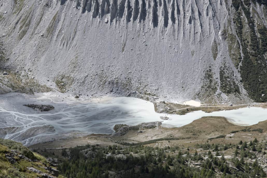
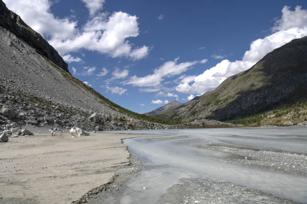
With the glaciers melting, the bottom of the Ferpècle valley hides one of the most beautiful alpine landscapes with spectacular moraines framing a wild, rocky alluvial plain. Overflowing glacial streams have created small lakes with turquoise water which reflect the majestic Dent Blanche. These same streams have also scattered sand banks, piles of pebbles and old, mysterious tree trunks across the landscape.
In this mountain setting, legend has it that, as well as a bucolic backdrop, the Ferpècle valley is an unstoppable source of energy: the silt which spreads from the foot of the Mont-Miné glacier is said to have therapeutic properties.
Legs not tired yet?
Start the ascent from Ferpècle (Le Salay) heading towards the dam, but before you get there, take the path on the left which leads to the Cabane de Bricola, a former hotel and mountain pasture standing at an altitude of 2,420m. The hike will take around 3.5 hours, with the route back following the same path. More experienced hikers can extend the route by taking the high-mountain path to the Dent Blanche Hut at an altitude of 2,640m.
A little history
In the past, the tongues of the two glaciers Ferpècle and Mont Miné connected to form a shared front which reached the hamlet of Salay at an altitude of 1,780m.
Retreating with time as a result of global warming, the shared tongue has divided into two branches and each glacier now occupies a separate valley either side of Mont Miné.
The Ferpècle glacier is a crossing point for Zermatt, and even Sion and Evolène via the Col d’Hérens, known to people since Roman times.
Global warming
Today, the glaciers continue to retreat, revealing previously inaccessible geological formations. On the Ferpècle mountain pasture, hikers can find roches moutonnées (rocks rounded by the glacier) as well as glacial potholes.
As you hike, watch out for the numbers painted on the rocks as you approach the glacial tongue: each number marks the glacier’s position that year.
The landscape changes year to year, with the glacial tongue receding roughly 26m every year as a result of ice melting and global warming – but its unique, wild beauty will continue to amaze you whatever the season
Alluvial site of national importance
With a drastic reduction in alluvial sites in Switzerland, whether from being destroyed or very strongly disrupted, in 1992 the Swiss Confederation set up a federal inventory of alluvial sites of national importance, grounded in the federal law on the protection of nature and the landscape, in order to protect and enhance the most precious alluvial sites in Switzerland.
Ferpècle is one such area.
![]() info@dixence-resort.ch
info@dixence-resort.ch
![]() +41 27 288 53 51 (For the sale of apartments and chalets)
+41 27 288 53 51 (For the sale of apartments and chalets)
![]() +41 27 563 00 50 (For the Grands Bains d'Hérémence)
+41 27 563 00 50 (For the Grands Bains d'Hérémence)
![]()
![]()
![]()

